Application Web gratuite en ligne pour les cartes de la NV

Application Web gratuite et en ligne de NV Charts pour la planification de votre voyage

Profitez également de l’application NV Charts sous forme de visualiseur de cartes en ligne, simplement dans votre navigateur et gratuitement, pour planifier une croisière ou explorer une nouvelle zone maritime, ainsi que comme guide en ligne des ports et des marinas. En vous inscrivant à l’application gratuite NV Charts Web App, vous pouvez également synchroniser facilement toutes les données sur vos appareils mobiles et commencer à naviguer directement à bord. La NV Charts Web App est la version en ligne de l’application populaire NV Charts et est le complément idéal à utiliser sur vos appareils mobiles en ligne dans votre navigateur, avec les dernières données cartographiques et un fonctionnement intuitif. Toutes les informations de la Community Layer avec les ports, les mouillages, les avertissements de navigation, les photos, les magasins et les lieux d’intérêt sont affichées directement en ligne dans l’application NV Charts, et des informations peuvent également être ajoutées par vous ou commentées. Vous pouvez partager vos ports et mouillages préférés avec l’application de navigation maritime en cliquant simplement sur un lien et coordonner la planification de votre voyage avec tous ceux qui sont à bord. Un outil de planification détaillé est disponible ici, en même temps que le site web communautaire de NV Charts Seame.com.

Continuer à enregistrer gratuitement
l’application Web NV Charts

Free online NV Charts Web App

Online and free NV Charts Web App for your trip planning

Enjoy the NV Charts App also as an online web viewer chart app simply in your browser free of charge for planning a cruise or exploring a new sea area and as an online harbour and marina guide. By registering with the free NV Charts Web App online nautical chart app, you can also easily synchronize all data to your mobile devices and start navigating on board directly. NV Charts Web App is the online version of the popular NV Charts App and is the ideal complement to use on your mobile devices online in your browser featuring the latest chart data and intuitive operation. All community layer information with ports, harbours, anchorages, navigation waring, photos, shops and places of interest are displayed directly online in the NV Charts App, and information can also be added by you or commented. You can share your favorite harbors and anchorages from the marine navigation app by simply clicking on a link and coordinate your trip planning with everyone on board. Together with the NV Charts community website Seame.com a detailed planning tool is available right here.

Continue to free
NV Charts Web App registration

NV Charts Web App

Online NV Charts Seekarten Web App für die Törnplanung

Genieße die NV Charts Seekarten App auch kostenlos online in deinem Browser zur Törnplanung oder Erkundung eines neuen Seegebietes und als online Hafenführer und Marina Guide. Mit der Anmeldung in der kostenlosen NV Verlag Online-Seekarte kannst du alle Daten auch einfach auf deine mobilen Geräte synchronisieren und direkt mit der Navigation an Bord starten. NV Charts Web App ist die Online-Version der beliebten NV Charts App und die ist die ideale Ergänzung zur Nutzung auf deinen mobilen Geräten, ganz einfach online im Browser. Gleiches Kartenbild und intuitive Bedienung. Alle Community Layer Informationen mit Häfen, Ankerbuchten, Navigationshinweisen, Fotos, Geschäften und Sehenswürdigkeiten sind direkt online in der NV Charts App dargestellt und  Informationen können auch ergänzt oder kommentiert werden. Deine Lieblings-Häfen und Ankerplätze kannst du aus der App einfach per Link teilen und die Törnplanung so noch besser mit allen an Bord abstimmen. Zusammen mit der NV Charts Community Website Seame.com ist hier ein detailliertes Planungswerkzeug verfügbar.

Weiter zur kostenlosen
NV Charts Web App Anmeldung

Harbour Guide presentaion

Nouvelle version de l’application NV Charts Version 2020

Pour la saison de navigation 2020, nous avons à nouveau développé une mise à jour importante pour l’application NV Charts.

Une façon d’avoir de superbes cartes nautiques à la fois sur papier et sur votre téléphone ou tablette est d’utiliser notre pack combiné populaire de cartes nautiques papier et numériques. Dans ce pack, vous obtenez des cartes nautiques en format atlas intelligent et des cartes nautiques numériques à utiliser dans l’application NV Charts, y compris un service de mise à jour pour un an. Mais il y a aussi l’achat direct de cartes nautiques numériques dans l’application NV Charts. L’avantage : vos cartes sont toujours à jour.

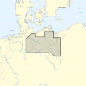
L’offre des nouvelles cartes vectorielles est un grand point fort des cartes marines pour la mer Baltique et la présentation avec une bibliothèque de symboles sophistiquée d’une qualité exceptionnelle. Il est particulièrement agréable de constater qu’ici aussi, une grande attention est accordée à la bonne présentation des cartes et que les identificateurs des bouées et des phares sont affichés sans clics supplémentaires. La mise en évidence des secteurs de phare est également une caractéristique de qualité, qui aide clairement à comprendre facilement les situations de chenal complexes, même sur la carte nautique numérique.

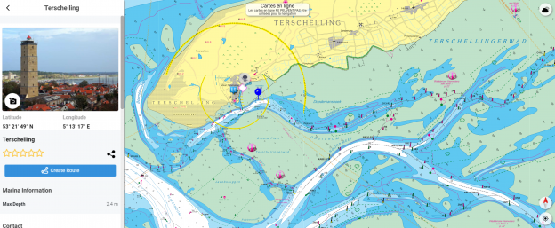
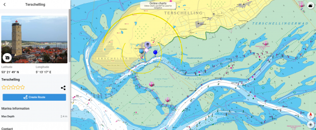
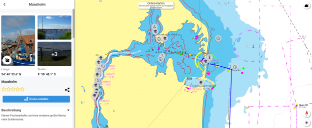
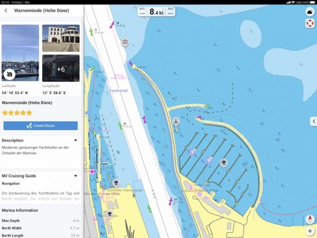
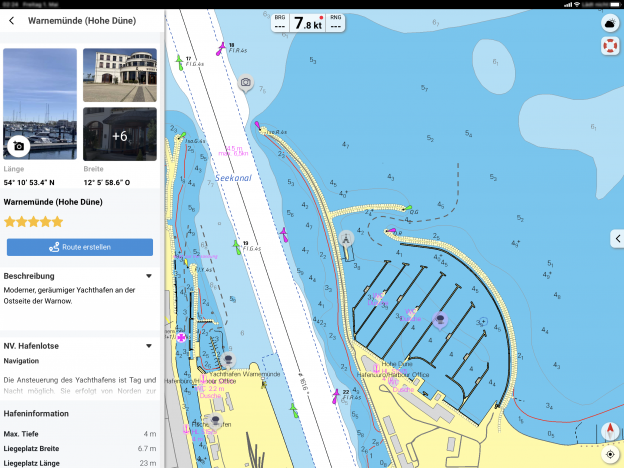
Les informations les plus récentes sont essentielles pour une navigation sûre sur l’eau. Avec la nouvelle version de l’application NV Charts 2020, vous avez maintenant la possibilité de faire partie de la communauté des cartes marines. Vous pouvez maintenant marquer les ports, les mouillages et les avertissements de navigation sur la carte marine numérique et également ajouter des lieux d’intérêt qui vont plus loin que la navigation, comme des restaurants ou des points d’intérêt avec des photos et les partager avec la communauté. D’autres peuvent répondre directement par des commentaires. Le contenu édité regulièrement peut être téléchargé directement pour être disponible hors ligne. Afin de rendre toutes les informations facilement accessibles, nous avons amélioré la fonction de recherche : vous pouvez explorer les environs et rechercher directement des noms de lieux ainsi que des mouillages, des ports, des rampes, des points de passage, des grues, des stations-service ou des stations de marée. En outre, une fonction d’auto-routage a été intégrée, qui vous permet de naviguer directement vers votre destination en utilisant l’application NV Charts comme un traceur GPS marine.

Jeppe Scheidt, développeur d’applications et marin, parle de l’application :

„Avec l’application NV Charts, nous avons tous la possibilité de partager nos expériences sur l’eau et de rendre l’expérience de la voile et des sports nautiques encore plus spéciale“.

Ensemble, la navigation à bord est encore plus amusante ! Vous pouvez maintenant partager vos tracks avec vos amis ou utiliser les données en dehors de l’application et les exporter sous forme de fichier GPX. Vous pouvez partager vos ports et mouillages préférés avec l’application en cliquant simplement sur un lien et coordonner encore mieux la planification de votre voyage avec tout le monde.

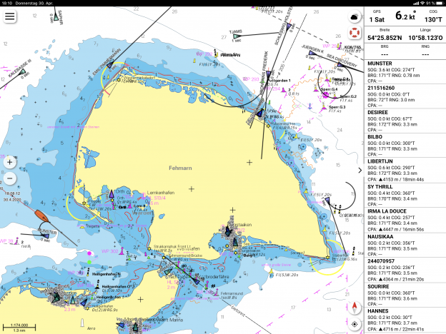
Grâce à la fonction AIS de l’application NV Charts, vous pouvez garder un œil sur les signaux AIS en temps réel. Un récepteur AIS avec Wifi peut être connecté à l’application NV Charts. De cette façon, les destinations de classe A et B de l’AIS, les aides à la navigation (ATON) ainsi que les émetteurs de détresse à transpondeur MOB AIS SART sont affichés directement sur la carte marine numérique en temps réel et la situation du trafic peut être mieux évaluée. Pour activer la fonction AIS dans l’application, seules les données d’accès au routeur AIS doivent être saisies sous Paramètres (IP et Port). L’application NV Charts fonctionne avec de nombreux récepteurs AIS et a été testée avec les appareils suivants :
Actisense’s W2K-1 https://www.actisense.com/product/w2k-1/
Weatherdock Wifi AIS https://www.easyais.com/en/products/ais-receivers/
Il s’agit d’un format standard et tout récepteur AIS envoyant du NMEA 0183 via Wifi TCP-IP (ce que font la plupart des gens, et qui peut généralement être facilement configuré) devrait être compatible.

### NOUVEAUX POINTS FORTS ###
✔ Fonction de recherche
✔ Autorouting
✔ Community Layer / Points d’intérêt (POI)
✔ Amélioration du journal de bord et de l’enregistrement des parcours
✔ Aperçu gratuit en ligne des cartes marines pour la planification
✔ Les cartes nautiques actuelles pour 2020 indiquent déjà les nouvelles zones de séparation du trafic prévues dans la mer Baltique
✔ Application sur le site Web de cartographie NV en ligne pour la planification de voyages avec des cartes marines et des informations portuaires gratuites https://app.nvcharts.com
✔ Avertissements de navigation directement dans l’application NV Charts

### AUTRES POINTS FORTS ###
✔ Achats directes dans l’application de cartes nautiques numériques
✔ Cartes marines vectorielles pour la mer Baltique
✔ Courants en temps réel dans la mer du Nord et la mer Baltique
✔ Prévision des marées et météo en ligne
✔ Mises à jour régulière pour l’édition achetée
✔ NMEA Wind et Support EchoSounder
✔ Connexion AIS avec Support AIS SART MOB
✔ Synchronisation avec d’autres appareils + exportation de fichiers
✔ Navigation avec un GPS intégrée

## Conditions nécessaires pour cette version
## IOS Version 13
## Android version 7.0+
## Windows 10, 8
## Mac OSX 10.13 10.14 10.15 (version actuelle)
(pour tous ceux qui ont des appareils plus anciens, la version précédente est toujours disponible avec l’application NV Charts Classic)

Harbour Guide presentaion

New NV Charts App Version 2020

For the boating season 2020 we have again provided a large update for the NV Charts App.

One way to have great nautical charts both on paper and or the gps navigation on our phone or tablet is to use our popular combination pack of paper and digital nautical charts, which includes both charts in clever atlas format and digital nautical marine boating charts/maps for use in the NV Charts App, including a update service for the edition purchased. This is of course the safer option for your navigation solution. However, you can also purchase digital boating charts as a subscription directly in the NV Charts App. The subscription duration is one year and is automatically extended (unless cancelled). The advantage: your boating charts are always up to date in the NV Charts marine GPS navigation app.
If it is not yet clear where the journey is going to take you, free online charts can be displayed for all NV Charts nautical chart areas in the app, or in your browser.

The offer of the new vector charts is an absolute highlight of the sea charts for the Baltic Sea and the presentation with a sophisticated symbol library of outstanding quality. Especially nice is, that here again a lot of attention is paid to the good presentation of the charts and that also the identifiers of buoys and lighthouses are shown without extra clicks. Highlighted lighthouse sectors are also a quality feature, which clearly helps to easily understand even complex fairway situations, even in the digital nautical chart.

The latest information is essential for safe navigation on the water. With the new version of the NV Charts App 2020 you have the possibility to become part of the chart community. You can now add marinas, anchorages and navigation warnings to the digital chart and also add and share interesting places beyond navigation, such as restaurants or points of interest with pictures. Others can respond directly with comments. The continuously edited content can be downloaded directly to be available offline. In order to make all information easily accessible, we have improved the search function: You can explore the surroundings and search directly for place names as well as anchorages, harbours, ramps, waypoints, cranes, petrol stations, or tide stations. In addition, an auto-routing function has been integrated, which allows you to navigate directly to your destination using the NV Charts App as a marine GPS Plotter.

Jeppe Scheidt, app developer and sailor says about the app:

„With the NV Charts app we all have the opportunity to share our experiences on the water and together make the sailing and water sports experience even more exciting“.

Together navigation on board is even more fun! You can now share your tracks with friends or use the data outside the app and export it as GPX file. You can share your favorite harbors and anchorages from the app simply by clicking on a link and coordinate your trip planning even better with everyone.

With the AIS function in the NV Charts App you can keep an eye on AIS signals in real-time. You can connect a Wlan AIS receiver to the NV Charts and the app display AIS Class A and B signals and navigation aids (ATON), as well as MOB AIS SART transponder distress transmitters, directly in the digital chart in real-time and the traffic situation can be assessed better. To activate the AIS function in the app, only the access data for the AIS router must be entered under Settings (IP and Port). The NV Charts App works with many AIS receivers and was tested with the following devices:
Tested AIS devices for NV Charts App:
Actisense’s W2K-1 https://www.actisense.com/product/w2k-1/
Weatherdock Wifi compatible devices https://www.easyais.com/en/products/ais-receivers/
Digital Yacht devices https://digitalyacht.net/2020/06/02/nv-charts-digital-yacht-ais/
But this is a standard format and really any AIS receiver sending NMEA 0183 over Wifi TCP-IP (which most do, and this can usually be easily configured) should be compatible.

### NEW HIGHLIGHTS ###
✔ Search function
✔ Autorouting
✔ Community Layer / Points of Interest(POI)
✔ Improved logbook and track recording
✔ Free online nautical charts in App preview for planning
✔ The updated charts for 2020 already show the planned new traffic separation areas in the Baltic Sea
✔ Online NV Charts Web App for trip planning with free sea charts and port information https://app.nvcharts.com
✔ Navigation warnings directly in the NV Charts App

### OTHER HIGHLIGHTS ###
✔ In App Purchases of digital sea charts
✔ Vector charts for the Baltic Sea
✔ Real-time currents in the North Sea and Baltic Sea
✔ Tide prediction and online weather
✔ Continuous updates
✔ NMEA wind and echo sounder support
✔ AIS connection incl. AIS SART MOB support
✔ Synchronization with other devices + file export

## System requirements of this version
## IOS Version 13
## Android version 7.0+
## Windows 10, 8
## Mac OSX 10.13 10.14 10.15 (current version)
(for all who have older devices the previous version is still available as NV Charts Classic)

Harbour Guide Darstellung NV Charts App

Neue NV Charts App Version 2020

Für die neue Saison 2020 haben wir wieder ein umfangreiches Update für die NV Charts App bereitgestellt.

Eine Möglichkeit, großartige Seekarten sowohl in Papierform als auch für die GPS Navigation auf deinem Telefon oder Tablet zu haben, ist die Verwendung unseres beliebten Kombipack aus Papier- und digitalen Seekarten, mit welchem du sowohl Seekarten im cleveren Atlasformat als auch digitale Seekarten zur Verwendung in der NV Charts App erhältst – incl. Update Service für die Edition. Es gibt aber auch den direkten In-App-Kauf von digitalen Seekarten Abos in der NV Charts App. Die Abonnementdauer beträgt ein Jahr und wird automatisch verlängert. Der Vorteil: Deine Karten sind auch hier immer auf dem aktuellsten Stand.

Das Angebot der neuen Vektorkarten ist dabei ein absolutes Highlight der Seekarten für die Ostsee und die Darstellung mit einer ausgefeilten Symbol-Bibliothek von herausragender Qualität. Besonders schön ist dabei, das hier auch wieder große Aufmerksamkeit auf die gute Darstellung der Karten gelegt wird und die auch die Kennungen an Tonnen und Leuchttürmen ohne extra Klicks anzeigt werden. Hervorgehobene Leuchtturm Sektoren sind dabei auch ein Qualitätsmerkmal, welches eindeutig dabei hilft auch komplexe Fahrwassersituationen, auch in der digitalen Seekarte, leicht zu verstehen.

Die aktuellsten Informationen sind essenziell um sicher auf dem Wasser zu mit Segel- oder Motorbooten zu navigieren. Mit der neuen Version der NV Charts App 2020 gibt es nun die Möglichkeit selbst Teil der Karten-Community zu werden. Du kannst nun Häfen, Ankerplätze und Navigationswarnungen in der digitalen Seekarte markieren und auch interessante Orte, die über die Navigation hinausgehen, wie Restaurants oder Sehenswürdigkeiten mit Bildern hinzufügen und mit der Community teilen. Andere können direkt mit Kommentaren reagieren. Die laufend redaktionell begleiteten Inhalte können direkt heruntergeladen werden, um dann offline verfügbar zu sein. Um alle Informationen leicht zugänglich zu machen, haben wir die die Suchfunktion verbessert: Du kannst die Umgebung erkunden und direkt nach Ortsnamen sowie Ankerplätzen, Häfen, Rampen, Wegpunkten, Kränen, Tankstellen oder Tidenstationen suchen. Zusätzlich wurde eine Auto-Routing Funktion integriert mit der du direkt zu deinem Ziel mit GPS navigieren kannst.

Jeppe Scheidt, App-Entwickler und Segler sagt über die App:

„Mit der NV Charts App haben  wir alle auf dem Wasser die Möglichkeit, unsere Erfahrungen zu teilen und dadurch das Segel- und Wassersporterlebnis gemeinsam noch besonderer zu machen.“

Gemeinsam macht Navigation an Bord noch mehr Spaß! Es gibt nun die Möglichkeit, deine Tracks mit Freunden zu teilen oder die Daten außerhalb der App zu verwenden und als GPX-Datei exportieren. Deine Lieblings-Häfen und Ankerplätze kannst du aus der App einfach per Link teilen und die Törnplanung so noch besser mit allen abstimmen.

Mit der AIS Funktion in der NV Charts App können AIS Signale in Echtzeit im Blick behalten werden. Dazu kann einen Wlan AIS Empfänger an die NV Charts App angeschlossen werden. So werden die AIS Class A und B Ziele,  Navigationshilfen (ATON) sowie auch MOB AIS SART Transponder Notsender direkt in der digitalen Seekarte in Echtzeit angezeigt und die Verkehrssituation kann besser beurteilt werden. Um die AIS Funktion in der App zu aktivieren müssen unter Einstellungen nur die Zugangsdaten für den AIS Router eingegeben werden (IP und Port). Die NV Charts App funktioniert dabei mit vielen AIS Empfängern und wurde mit folgenden Geräten gestestet:
Actisense’s W2K-1 https://www.actisense.com/product/w2k-1/
Weatherdock Wifi kompatible Geräte https://www.easyais.com/produkte/ais-sendeempfaenger
Digital Yacht Geräte https://digitalyacht.net/2020/06/02/nv-charts-digital-yacht-ais/
Aber dies ist ein Standardformat und wirklich jeder AIS-Empfänger, der über Wifi TCP-IP NMEA 0183 sendet (was die meisten tun, und dies kann normalerweise einfach konfiguriert werden) sollte kompatibel sein.

### NEUE HIGHLIGHTS ###
✔ Suchfunktion
✔ Autorouting
✔ Community Layer / Points of Interest(POI)
✔ Verbesserte Logbuch und Trackaufzeichnung
✔ Kostenlose online Seekarten Vorschau für die Planung
✔ In den aktuellen Karten 2020 sind bereits die geplanten neuen Verkehrstrennungsgebiete in der Ostsee dargestellt
✔ Online NV Charts Web App für die Törnplanung mit kostenlosen Seekarten und Hafeninformationen https://app.nvcharts.com
✔ Navigationswarnungen direkt in der NV Charts App

### WEITERE HIGHLIGHTS ###
✔ In App Käufe digitaler Seekarten
✔ Vektor Seekarten für die Ostsee
✔ Echtzeitströmungen in der Nordsee und Ostsee
✔ Gezeiten Prognose und Online Wetter
✔ Kontinuierliche Updates
✔ NMEA Wind und Echolot Support
✔ AIS Anbindung incl. AIS SART MOB support
✔ Synchronisation mit anderen Geräten + Datei Export

## Systemvoraussetzungen dieser Version
## IOS Version 13
## Android Version 7.0+
## Windows 10, 8
## Mac OSX 10.13 10.14 10.15 (aktuelle Version)
(für alle die ältere Geräte haben ist die vorherige Version weiterhin als NV Charts Classic verfügbar)

AIS dans l’application NV Charts

Connectez votre application NV Charts App avec un appareil AIS compatible WLAN (Wifi) à bord et recevez toutes les cibles AIS sur votre appareil mobile. L’application NV Charts App affiche les navires de classe A et B, les aides à la navigation (ATON) ainsi que les émetteurs de détresse à transpondeur MOB AIS SART directement sur la carte numérique en temps réel. L’affichage en temps réel des autres positions AIS des navires à proximité permet de mieux évaluer la situation du trafic. En même temps, le nom et l’indicatif du navire affichés peuvent également aider à établir le contact via VHF. Lorsque les émetteurs d’urgence sont affichés, une route vers la position de réception est automatiquement créée et la route actuelle est terminée. Dans un tableau de bord situé sur la droite de l’écran, les navires à proximité peuvent être observés et le point d’approche le plus proche (CPA) est clairement affiché.
Pour activer la fonction AIS dans l’application, seules les données d’accès au routeur AIS doivent être enregistrées sous Paramètres ; GPS/AIS (adresse IP et port).
L’application NV Charts fonctionne avec de nombreux récepteurs AIS et a été testée avec les appareils suivants :
Actisense’s W2K-1 https://www.actisense.com/product/w2k-1/
Appareils compatibles Wifi Weatherdock https://www.easyais.com/en/products/ais-receivers/
Mais il s’agit d’un format standard et tout récepteur AIS envoyant du NMEA 0183 via Wifi TCP-IP (ce que font la plupart des gens, et qui peut généralement être facilement configuré) devrait être compatible.

AIS in the NV Charts App

Connect your NV Charts App with a Wlan (Wifi) capable AIS device on board and receive all AIS targets on your mobile device. The NV Charts App displays class A and B vessels, navigation aids (ATON) as well as MOB AIS SART transponder distress transmitters directly in the digital chart in real time. With the display of other AIS positions of ships in the vicinity in real time, the traffic situation can be better assessed. At the same time, the displayed ship name and callsign can also help to establish contact via VHF. When emergency transmitters are displayed, a route to the receiving position is automatically created and the current route is terminated. In a dashboard on the right-hand side of the screen, ships in the vicinity can be observed and the point of closest approach (CPA) is clearly displayed.
To activate the AIS function in the app, only the access data for the AIS router must be saved under Settings > GPS/AIS (IP address and port).
The NV Charts App works with many AIS receivers and was tested with the following devices:
Actisense’s W2K-1 https://www.actisense.com/product/w2k-1/
Weatherdock Wifi compatible devices https://www.easyais.com/en/products/ais-receivers/
But this is a standard format and really any AIS receiver sending NMEA 0183 over Wifi TCP-IP (which most do, and this can usually be easily configured) should be compatible.

AIS in der NV Charts App

Verbinde deine NV Charts App mit einem Wlan (Wifi) fähigen AIS Gerät an Bord und empfange alle AIS Ziele auch auf deinem mobil Gerät. Dazu werden in der NV Charts App Empfangende Klasse A und B Schiffe, Navigationshilfen (ATON) sowie auch MOB AIS SART Transponder Notsender direkt in der digitalen Seekarte in Echtzeit dargestellt. Mit der Darstellung anderer AIS Positionen von Schiffen in der Umgebung in Echtzeit kann die Verkehrssituation besser beurteilt werden. Gleichzeitig kann der Dargestellte Schiffsname. und Rufzeichen auch bei der Kontaktaufnahme über UKW helfen. Bei der Darstellung von Notsendern wird automatisch eine Route zur empfangenden Position erstellt und die aktuelle Route beendet. In einem Dashboard am rechten Bildschirmrand können die Schiffe in der Nähe beobachtet werden und die übersichtlich der Punkt der dichtesten Annäherung (CPA) angezeigt werden.
Um die AIS Funktion in der App zu aktivieren müssen unter Einstellungen > GPS/AIS nur die Zugangsdaten für den AIS Router gespeichert werden (IP Adresse und Port).
Die NV Charts App funktioniert dabei mit vielen AIS Empfängern und wurde mit folgenden Geräten gestestet:
Actisense’s W2K-1 https://www.actisense.com/product/w2k-1/
Weatherdock Wifi kompatible Geräte https://www.easyais.com/produkte/ais-sendeempfaenger
Aber dies ist ein Standardformat und wirklich jeder AIS-Empfänger, der über Wifi TCP-IP NMEA 0183 sendet (was die meisten tun, und dies kann normalerweise einfach konfiguriert werden) sollte kompatibel sein.

In App Purchase Regions Available

One way of having great nautical charts in both paper and on your phone or tablet is using our popular combipacks and received both paper marine boating charts / maps in the clever atlas format and digital marine boating charts / maps for use in the NV Charts App. However, we also offer you the direct in app purchase of digital marine boating charts.

So you can purchase digital boating charts as a subscription directly in the navigation app. The subscription duration is one year and is automatically extended. The advantage: your boating charts are always up to date. The following regions can be selected in the NV Charts App >  Maps > Buy offline charts > digital subscription:

Digital boating charts covering the Bay of Biscay passage, coast of Spain and Portugal to Gibraltar and Atlantic passages incl. Atlantic Islands / Madeira – Canary Islands – Azores – Cape Verdes and passage to Caribbean

49,99€

Digital boating charts for the baltic sea and Kattegat from Skagen to Bornholm and Riga with complete German coast as well as Limfjord und south Danish islands.

49,99€

Digital boating charts for German inland water charts around Berlin, Mecklenburger Waters, River Oder and Peene and River Elbe including smaller channels.

49,99€

Digital boating charts for German and Danish North Sea Coast incl. Ems, Jade, Weser, Elbe and Eider

49,99€

Digital boating charts for the Neatherlands Coast incl. Borkum, Waddensee, Ijsselmeer Markermeer and Randmeere as well as Amsterdam, Rotterdam, Osterschlede und Westerschlede to Oostende

49,99€

Digital boating charts for the South Norwegian Coast incl. Oslofjord, Sorlandet, Flekkefjord and Stavanger

49,99€

Digital boating charts for the Croatian Coast from Trieste to Dubrovnik and incl. Montenegro

49,99€

Digital boating charts for the Frensh Coast from Oostende to San Sebastian incl. Cherbourg, St. Malo, Kanalinseln, Brest, Nantes, La Rochelle and Bordeaux

49,99€

Digital boating charts for the Souther UK Coast from Great Yarmouth to the Isles of Scilly incl. Thames and Solent

49,99€

Digital boating charts for the Western Mediterranean Sea from Gibraltar to Toulon

49,99€

Digital boating charts for the eastern Mediterranean Sea from Toulon to Naples incl. Sardinia and Corsica.

49,99€

Digital boating charts for the Caribbean Islands from Grenada to Dominican Republic (without Haiti) incl. Bermuda.

49,99€

Digital boating charts covering coastal Waters of Florida and ICW from Fernandina Beach to Key West and entire Bahamas.

49,99€

Digital boating charts for the entire coast of Cuba.

49,99€