Kategorie-Archiv: NV.Blog_Startseite_ENG_US

NV.Blog_Startseite_ENG_EU

The new App Update 2020 is here!

Ahoy dear water sports enthusiasts!

Gemeinsam macht Navigation an Bord noch mehr Spaß!

Together, navigation on board is even more fun!
For the boating season 2020 we have again provided a large update for the NV Charts App and a fantastic highlight is the possibility to become part of the charting community yourself. You can now add your favourite harbours and anchorages with pictures and share them with the community. Other users can react directly with comments. The continuously edited content can be downloaded directly to be available offline. This makes the NV Charts app uniquely well integrated navigation and planing on board.

Enjoy the NV Charts Web App online in your browser now for planning your next trip or exploring a new area.

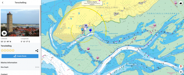
In order to make all information easily accessible, we have improved the search function: You can explore the surroundings and search directly for place names as well as anchorages, harbours, ramps, waypoints, cranes, petrol stations, or tide stations. In addition, an auto-routing function has been integrated, which allows you to navigate directly to your destination.

Have great fun on the water and especially while discovering the new app features!
Your NV Team


Download the NV Charts App for the appropriate operating system::


Points of Interest (POI)


POI, using Mönkeberg as an example


Auto-Routing*


The new auto-routing

The auto-routing allows en even easier route planning, taking the ship’s data into account. Destinations can be added or individual sections can be routed manually.
In addition, waypoints can be easily transferred to the paper chart (via the coordinates) or vice versa. This is not only for safety reasons and will of course practice all your practical navigation tallents, it is also a great opportunity to check the route in detail and discuss it with everyone on board.

*Auto-routing is currently available for our series of the Netherlands, the German North Sea and the Baltic Sea. Other areas will follow soon.


More highlights


✔ In-App purchases of digital charts
✔ Vector charts for the Baltic Sea
✔ Real-time currents in the North and Baltic Sea
✔ regular updates
✔ Tide Forecast and Online Weather
✔ NMEA wind and echo sounder support
✔ AIS connection incl. AIS SART MOB support
✔ Synchronization with other devices + file export
✔ the current charts 2020 already show the planned new traffic separation areas in the Baltic Sea

System requirements for the new app version:
## IOS Version 13
## Android version 7.0 or higher
## Windows 10, 8
## Mac OSX 10.13 10.14 10.15 (current version)

With the AIS function in the NV Charts App you can keep an eye on AIS signals in real-time. You can connect a Wlan AIS receiver to the NV Charts and the app display AIS Class A and B signals and navigation aids (ATON), as well as MOB AIS SART transponder distress transmitters, directly in the digital chart in real-time and the traffic situation can be assessed better.


Download the NV Charts App for the appropriate operating system:

Free online NV Charts Web App

Online and free NV Charts Web App for your trip planning

Enjoy the NV Charts App also as an online web viewer chart app simply in your browser free of charge for planning a cruise or exploring a new sea area and as an online harbour and marina guide. By registering with the free NV Charts Web App online nautical chart app, you can also easily synchronize all data to your mobile devices and start navigating on board directly. NV Charts Web App is the online version of the popular NV Charts App and is the ideal complement to use on your mobile devices online in your browser featuring the latest chart data and intuitive operation. All community layer information with ports, harbours, anchorages, navigation waring, photos, shops and places of interest are displayed directly online in the NV Charts App, and information can also be added by you or commented. You can share your favorite harbors and anchorages from the marine navigation app by simply clicking on a link and coordinate your trip planning with everyone on board. Together with the NV Charts community website Seame.com a detailed planning tool is available right here.

Continue to free
NV Charts Web App registration

nv charts will continue to distribute nautical charts and nautical publications in the coming days, weeks, months.

Our business with the supply nautical charts and equipping ships, yachts and boats with important nautical publications will continue, and accordingly our shipping operations are also running smoothly.
Well prepared for the comming water sports season!
We have built up stock, updated on the online presenation, freshly printed charts are ready for delivery to customers and new products area available in our web presentation.

Remote Support – Telephone Advise – technical help for our customers

Should you occur issues with nautical charts, installation of navigation software or with the unlocking of digital products, our experts will help you along.

We have established a technical support team for the nv charts App and related products.
Our colleagues are available Monday – Friday from 9:00 am to 1:00 pm via +49 (0)4351 860 99 21 or you send us an e-mail.


Reliable shipping with DHL – express service on request possible with UPS

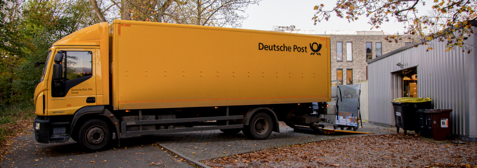
As usual we are delivering our parcels with DHL. Deutsche Post continues to work reliable and we have fast delivery times in Germany and all over Europe. The usual pick-up time in Eckernförde is 16:30hrs (local time), so if you can send us your order during the afternoon, we usually can send your charts the same evening.

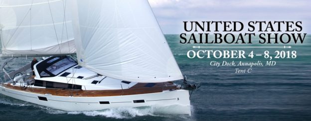
Meet us in Annapolis at the United States Sailboat Show

In October sailors from around the globe gather on miles of docks in beautiful historic Annapolis for the 2018 United States Sailboat Show. This is an internationally acclaimed sailboat show, recognized as the largest, most prestigious, and only remaining in-water sailboat show in the world.
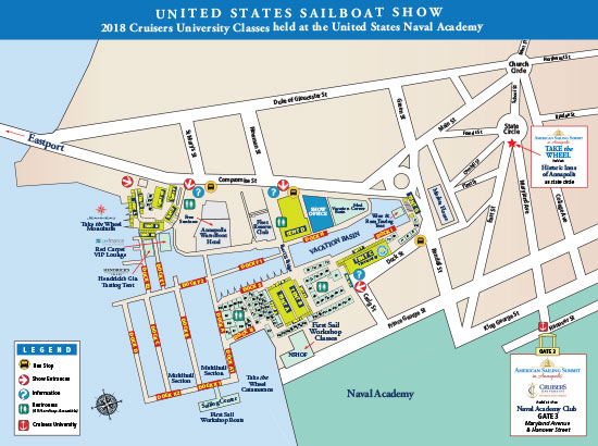
Meet us in Annapolis at the United States Sailboat Show, City Dock, Tent C

Please click to enlarge the map

United States Sailboat Show

NV Charts nominated for Dame Award

NV Charts’ new NV Atlas chart format has been nomintaed for the prestigious DAME Design Award, ‪#‎DameAward‬, the most prestigious international design competition for new marine equipment and accessories at the ‪#‎METS‬ Metstrade show this year in  Amsterdam. We thank you and the DAME Design Award Jury for liking our new NV Atlas chart format, a revolutionary new design approach that’s so handy and easy to use! Visit us in our #METS booth, Hall 4, Stand 133, and let us show it to you.  ‪#‎metstrade‬