Les préparations pour la saison 2021 sont en cours !

Peu à peu, on se rapproche à nouveau du début de la saison et tous les préparations sont en plein cours.
Malgré les changements de conditions qui nous accompagnent depuis plusieurs mois, nous travaillons avec la même qualité et motivation élevée auxquelles vous êtes habitués de notre part et comme d’habitude, nous mettons à jour nos atlas régulièrement.

Comme dans les saisons précédentes, il y a eu de nombreux changements, comme la création de nouvelles marinas, le déplacement des bouées, la modification des zones d’accès restreint et des bancs de sable et des chenaux déplacés.

Nous attendons les cartes actualisées de la mer Baltique pour fin février, et les nouvelles cartes de la mer du Nord allemande et des Pays-Bas pour fin mars.
La côte atlantique française (FR 1 à FR 7) et la FR10 pour la Méditerranée seront elle aussi complètement mise à jour cette année.

En plus des cartes marines, nous améliorons constamment notre application NV Charts, en tenant compte des suggestions et des souhaits de nos clients dans la mesure du possible. Vous pouvez donc vous attendre à de nouvelles optimisations pour l’année 2021.

Nous espérons que la saison – pour vous et pour nous également- pourra démarrer comme d’habitude. Nous sommes heureux de recevoir vos précommandes dès maintenant.

Restez en bonne santé et réjouissez-vous de nombreuses journées de détente sur l’eau !

Votre équipe NV

PS : Découvrez dès maintenant les ports et les mouillages pour la saison 2021 sur SeaMe.com

Preparations for the 2021 season are underway!

We are heading back towards the start of the season and all preparations are in full swing.
Despite the changed conditions, which have also been with us for months now, we are working to the same quality and high standards that you have come to expect from us and are updating our nautical chart sets as usual.

Again there are thousands of changes this season such as new marinas, relocated buoys, changed restricted areas and altered sandbanks and fairways.

We expect the updated charts for the Baltic Sea at the end of February, the new chart sets for the German North Sea and the Netherlands will be released at the end of March.
The French Atlantic coast (FR 1 to FR 7) will also be completely updated this year.

In addition to nautical charts, we are also continuously improving our NV Charts App, always taking into account the feedback and wishes of our customers wherever possible. So you can expect some optimisations and highlights for the year 2021.

We hope that the season – both for you and for us – can start as usual and we are already happy to take your pre-orders.

Stay healthy and look forward to exciting days on the water!

Your NV Charts Team

PS: Discover ports and anchorages for the 2021 season on SeaMe.com

Die Vorbereitungen für die Saison 2021 laufen!

Langsam geht es wieder in Richtung Saisonstart und alle Vorbereitungen für diesen laufen auf Hochtouren.
Trotz der veränderten Bedingungen, die natürlich auch uns seit Monaten begleiten, arbeiten wir in der gleichen Qualität und den selben hohen Ansprüchen, die Sie von uns gewohnt sind und aktualisieren wie üblich unsere Seekartensätze.

Auch in dieser Saison gibt es tausende Änderungen wie neue Marinas, verlegte Tonnen, geänderte Sperrgebiete und veränderte Sandbänke und Fahrwasser.

Die aktualisierten Karten für die Ostsee erwarten wir Ende Februar, die neuen Kartensätze für die deutsche Nordseeküste und die Niederlande erscheinen Ende März.
Auch die französische Atlantikküste (FR 1 bis FR 7) wird dieses Jahr komplett aktualisiert.

Neben den Seekarten verbessern wir auch unsere NV Charts App fortlaufend weiter und berücksichtigen dabei nach Möglichkeit stets die Anregungen und Wünsche unserer Kunden. So können Sie auch für das Jahr 2021 wieder mit einigen Optimierungen rechnen.

Wir hoffen, dass die Saison – sowohl für Sie als auch für uns – wie gewohnt starten kann und gerne nehmen wir bereits jetzt Ihre Vorbestellungen entgegen.

Bleiben Sie gesund und freuen Sie sich schon einmal mit uns auf erholsame Tage auf dem Wasser!

Ihr NV Team

PS: Entdecken Sie bereits jetzt Häfen und Ankerbuchten für die Saison 2021 auf SeaMe.com

Wir gehen in die Winterpause!

Weihnachten klopft an die Tür!

Wir wünschen all unseren Kunden und Lieferanten ein besinnliches Weihnachtsfest – auch wenn es in diesem Jahr sicherlich nicht bei jedem so sein wird wie gewohnt.

Rutschen Sie gut in die nächste Saison – es kann nur besser werden!


NV CHARTS macht Winterpause!

Das Team von NV CHARTS ist vom 19.12.2020 bis 10.01.2021 nicht erreichbar.
Bestellungen können noch bis zum 18.12.2020 bearbeitet werden.

Ab dem 11.01.2021 sind wir wieder für Sie da!

Notre application a été testé par Digital Yacht : Compatibilité confirmée

Digital Yacht – Fabricants de la prochaine génération de systèmes de navigation, de communication et de divertissement- a testé notre application et publié un article sur la connexion entre l’application, ses produits AIS et les données GPS. Vous pouvez trouver cet article ci-dessus, nous espérons que vous prendrez plaisir à le lire.

NV Charts & Digital Yacht AIS

« Depuis des décennies, NV Charts produit des cartes marines pour la mer Baltique, la mer du Nord, le Kattegat, le Skagerak et la côte sud de la Norvège. La couverture des cartes s’étend au Royaume-Uni, à la côte atlantique européenne, à la côte est des États-Unis, aux Caraïbes et à la Méditerranée. Avec un bon œil pour le détail et des connaissances locales précises, chaque carte nautique est créée avec les meilleures données disponibles. Dans de nombreux cas, les propres données détaillés complètent les cartes nautiques officielles du bureau hydrographique. Les cartes NV sont également faciles à lire et disposent d’une belle palette de couleurs et d’un joli schéma d’écriture et de symboles. Les cartes sont disponibles en format papier et numérique – et si vous achetez une carte papier, vous recevrez une application à télécharger gratuitement. C’est génial – la navigation traditionnelle rencontre l’iPad !

La version électronique est maintenant compatible avec les produits Digital Yacht AIS et NMEA aux interfaces sans fil. Cela veut dire que les données AIS, des instruments et de GPS du bateau peuvent être montré dans les cartes détaillées, transformant votre appareil (iPad ou tablette) en un système de cartes électroniques entièrement fonctionnel avec routage, suivi en temps réel et AIS-Overlays. Nous avons utilisé un iPad pour un test avec les cartes NV et le Digital Yacht AIT3000 et le transpondeur iAISTX de classe B. Dans la capture d’écran ci-dessous, vous pouvez voir le schéma de couleurs claires et faciles à utiliser ainsi que les symboles des marqueurs de navigation. Votre position actuelle du GPS du bateau (qui est bien meilleur que le GPS interne sur certaines tablettes, parce que ça prend beaucoup d’électricité) est indiquée par un triangle rouge avec une ligne de parcours. Si vous utilisez le système du bateau, vous n’avez pas besoin d’un iPad GPS/cellulaire trop cher et, bien sûr, vous n’avez pas besoin d’une connexion internet.

Activer simplement l’AIS pour que les destinations s’affichent automatiquement. Ci-dessous, vous pouvez voir la destination juste à l’est de South Haven Point avec une ligne de prévision de trajectoire indiquant un point de collision possible. Cliquez sur la destination et plus d’informations sont affichées dans la fenêtre de données – le calcul du CPA (prochain point de rencontre) et du TCPA (temps jusqu’au CPA) ainsi que la distance et le relèvement sont également affichés.

Les cartes peuvent être configurées pour afficher „Cours en haut“ et „Nord en haut“ et des Waypoints et des routes peuvent être créés en quelques secondes. Il existe également une fonction de journal de bord auquel on peut joindre des images. La capture d’écran ci-dessous montre des destinations avec des données de nom attachées – idéal pour lancer un appel VHF à une cible de collision potentielle ou à un compagnon de bateau.

Tout cela sont des choses pratiques – et une vraie raison d’utiliser un iPad pour toutes les tâches de navigation sur votre bateau. Les solutions de navigation sans fil de Digital Yacht offrent non seulement un excellent rapport qualité-prix, mais vous pouvez maintenant choisir entre plusieurs applications avec différents types de cartes qui transforment votre iPad en un véritable système multicartes. Pour les eaux britanniques, les applications iPad offrent désormais une compatibilité avec C-Map, UKHO/Admiralty, Navionics, S57 Vector ECDIS style, Imray et maintenant NV Charts. Des applications conviviales, sophistiquées et rentables pour la navigation de la prochaine génération.»


Cliquez ici pour plus d’informations sur Digital Yacht.

La nouvelle mise à jour de 2020 pour l’application est disponible !

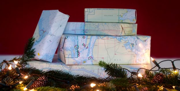
Bonjour chers amateurs de sports nautiques !

Ensemble, la navigation à bord est encore plus passionnante !

De nombreuses nouvelles fonctionnalités ont été ajouté à l’application NV Charts et grâce à la nouvelle version, il est maintenant possible pour nous tous de faire partie de la communauté des cartes. Vous pouvez ajouter vos ports et mouillages préfère avec des photos et les partager avec la communauté. Les autres utilisateurs peuvent réagir directement avec des commentaires. Le contenu est édité régulièrement et peut être téléchargé directement pour être disponible hors ligne. L’application NV Charts est donc particulièrement bien intégrée à votre navigation à bord.

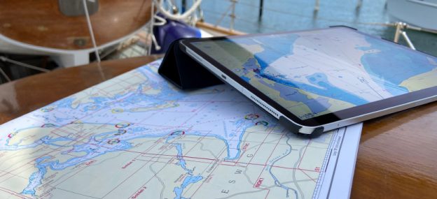
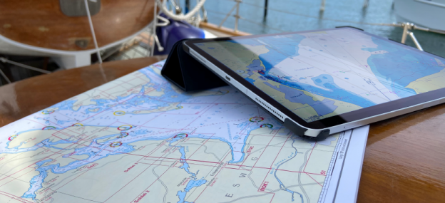
Profitez maintenant de l’application Web NV Charts en ligne dans votre navigateur pour planifier votre voyage ou découvrir une nouvelle zone maritime.

Pour rendre toutes les informations facilement accessibles, nous avons ajouté une nouvelle fonction de recherche : Vous pouvez explorer les environs et rechercher directement des noms de lieux ainsi que des mouillages, des ports, des rampes, des points de passage, des grues, des stations-service ou des stations de marée. En outre, une fonction d’auto-routage a été intégrée, avec laquelle vous pouvez naviguer directement à votre destination en utilisant l’application NV Charts comme un traceur GPS marine.

Nous vous souhaitons beaucoup de plaisir sur l’eau et en découvrant les nouvelles fonctionnalités de l’application !

Votre équipe NV Charts


Téléchargez l’application NV Charts pour le système d’exploitation adapté pour votre appareil :


Points of Interest (POI)


Un POI pour l’exemple de Mönckeberg


Auto-Routing*


Le nouveau Auto-Routing

L’auto-routage permet maintenant de planifier encore plus facilement votre route en tenant compte des données du bateau. Vous pouvez ajouter des destinations ou déterminer manuellement des sections individuelles. En outre, les points de cheminement peuvent être facilement transférés sur la carte papier via les coordonnées ou vice versa. Ce n’est pas seulem ent pour des raisons de sécurité et parce que ça pratique toutes les méthodes de navigation, c’est aussi une bonne occasion de vérifier une nouvelle fois la route et d’en discuter avec tout le monde à bord.

* Pour le moment, le routage automatique est disponible pour nos séries des Pays-Bas, de la mer du Nord allemande et de la mer Baltique. D’autres régions suivront prochainement


D’autres Points forts


✔ Achats de cartes numériques dans l’application
✔ Cartes vectorielles pour la mer Baltique
✔ Courants en temps réel dans la mer du Nord et la mer Baltique
✔ Mises à jour régulières pour l’édition achetée
✔ Prévision des marées et météo en ligne
✔ NMEA Wind et Echolot Support
✔ Connexion AIS avec support AIS SART MOB
✔ Synchronisation avec d’autres appareils + exportation de fichiers
✔ Les cartes actuelles de 2020 montrent déjà les nouvelles zones de séparation du trafic prévues dans la mer Baltique
✔ Navigation avec un GPS intégrée

Conditions nécessaires pour cette version:
## IOS Version 13
## Android Version 7.0 ou plus haut
## Windows 10, 8
## Mac OSX 10.13 10.14 10.15 (version actuelle)

Grâce à la fonction AIS de l’application NV Charts, vous pouvez vérifier les signaux AIS en temps réel. Pour faire cela, un récepteur AIS avec Wifi peut être connecté à l’application NV Charts. Comme ça, les cibles AIS de classe A et B, les aides à la navigation (ATON) ainsi que les émetteurs de détresse à transpondeur MOB AIS SART sont affichés directement dans la carte marine numérique en temps réel et la situation du trafic peut être mieux évaluée.


Téléchargez l’application NV Charts pour le système d’exploitation adapté pour votre appareil :


Unsere App wurde von Digital Yacht getestet: Kompatibilität bestätigt

Digital Yacht – Hersteller von Navigations-, Kommunikations- und Unterhaltungssystemen der nächsten Generation – hat unsere App getestet und einen schönen Artikel über die Verbindung zwischen der App, ihren AIS-Produkten und GPS-Daten veröffentlicht.
Wir möchten Ihnen den Artikel nicht vorenthalten und wünschen Ihnen viel Spaß beim Lesen.

NV Charts & Digital Yacht AIS

NV Charts erstellt seit Jahrzehnten Seekarten für die Ostsee, Nordsee, Kattegat, Skagerak und die norwegische Südküste. Die Kartenabdeckung erstreckt sich nun auch auf das Vereinigte Königreich, die europäische Atlantikküste, die Ostküste der USA, die Karibik und das Mittelmeer. Mit viel Liebe zum Detail und präzisen Ortskenntnissen wird jede Seekarte aus den bestmöglichen, verfügbaren Daten erstellt. In vielen Fällen ergänzen die eigenen detaillierten Vermessungsdaten die offiziellen Seekarten des Hydrographischen Amtes.
NV Karten sind außerdem leicht zu lesen und verfügen über eine schöne Farbpalette und ein schönes Schrift-/Symbolschema. Die Karten sind sowohl im Papier- als auch im Digitalformat erhältlich – und wenn Sie eine Papierseekarte kaufen, erhalten Sie einen kostenlosen App-Download dazu. Das ist großartig – traditionelle Navigation trifft auf das iPad!

Die elektronische Version ist jetzt kompatibel mit Digital Yacht AIS-Produkten und NMEA zu drahtlosen Schnittstellen. Das bedeutet, dass die AIS-, Instrumenten- und GPS-Daten des Bootes in die detaillierten Karten eingeblendet werden können, wodurch Ihr Gerät (iPad oder Tablet) in ein voll funktionsfähiges, elektronisches Kartensystem mit Routing, Echtzeit-Tracking und AIS-Overlays verwandelt wird. Wir haben ein iPad für einen Test mit NV Charts und der Digital Yacht AIT3000 sowie dem iAISTX Class B Transponder verwendet.
In dem Screenshot unten sehen Sie das helle, einfach zu verwendende Farbschema und die Symbole für die Navigationsmarken. Ihre aktuelle Position aus dem GPS des Bootes (das viel besser ist als das Strom ziehende interne GPS auf einigen Tabletts) wird als rotes Dreieck mit einer Kurslinie angezeigt. Wenn Sie das System des Bootes benutzen, brauchen Sie kein teures GPS/Zellular-fähiges iPad und natürlich ist auch keine Verbindung zum Internet erforderlich.

Aktivieren Sie einfach das AIS und die Ziele werden automatisch angezeigt.
Unten sehen Sie das Ziel direkt östlich von South Haven Point mit einer Kursvorhersage-Linie, die einen möglichen Kollisionspunkt anzeigt. Klicken Sie auf das Ziel und weitere Informationen werden im Datenfenster angezeigt – auch die Berechnung von CPA (nächster Punkt des Zusammentreffens) und TCPA (Zeit bis zum CPA) sowie die Entfernung und Peilung werden dargestellt.

Die Karten können für die Darstellung mit ‚Kurs oben‘ und ‚Norden oben‘ konfiguriert werden und Wegpunkte sowie Routen können in Sekundenschnelle erstellt werden. Es gibt auch eine übersichtliche Logbuchfunktion, an die Bilder angehängt werden können.
Der untenstehende Screenshot zeigt Ziele mit angehängten Namensdaten – ideal, um einen VHF-Anruf an ein potenzielles Kollisionsziel oder einen Bootskameraden zu initiieren.

Das sind alles super Sachen – und ein echter Grund, ein iPad für alle Navigationsaufgaben auf Ihrem Boot zu verwenden. Die drahtlosen Navigationslösungen von Digital Yacht bieten nicht nur ein hervorragendes Preis-Leistungs-Verhältnis, sondern Sie haben jetzt auch die Wahl zwischen mehreren Apps mit verschiedenen Kartentypen, die Ihr iPad in ein echtes Multi-Karten-System verwandeln. Für britische Gewässer bieten die iPad-Apps jetzt Kompatibilität mit C-Map, UKHO/Admiralty, Navionics, S57 Vector ECDIS style, Imray und jetzt auch NV Charts. Benutzerfreundliche, anspruchsvolle und kostengünstige Apps für die Navigation der nächsten Generation.“


Klicken Sie hier für weitere Informationen über Digital Yacht.

Our App got tested by Digital Yacht: Compatibility confirmed

Digital Yacht – producer of next generation navigation, communication and entertainment systems – tested our App and published a nice article about the connection between the App, their AIS products and GPS data.
We don’t want to withhold the article from you and hope you enjoy reading it.

NV Charts & Digital Yacht AIS

„For decades, NV Charts have been creating nautical charts for the Baltic Sea, North Sea, Kattegat, Skagerak and the Norwegian south coast.  Chart coverage now extends to the UK, European Atlantic Coast, E Coast USA, Caribbean and Mediterranean.  With a keen eye on detail and precise local knowledge, every nautical chart is designed from the best available data. In many cases, their own detailed survey data supplements official hydrographic office charts.  NV Charts are also easy to read have have a nice colour palette and font/symbol schema.  Their charts are available in paper and digital format – and if you purchase a paper chart, it comes with a free app download too.  That’s great – traditional navigation meets the iPad!

The electronic version is now compatible with Digital Yacht AIS products and NMEA to wireless interfaces.  This means the boat’s AIS, instrument and GPS data can be overlaid onto the detailed charts turning your device (iPad or tablet) into a full function electronic chart system with routing, real time tracking and AIS overlays.  We took an iPad for a test with NV and the Digital Yacht AIT3000 and iAISTX Class B transponder.  You’ll see in the screen shot below the bright, easy to use colour scheme and icons for navigation marks.  Your current position from the boat’s GPS (which is much better than the battery thirsty internal GPS on some tablets) shows as a bold, red triangle with a heading vector.  Using the boat’s system means you don’t need an expensive GPS/Cellular enabled iPad and of course, no connection to the internet is required.

Just enable AIS and targets display automatically.  You’ll see the target just to the east of South Haven Point with a heading predictor showing a potential collision point.  Click on the target and more information is displayed in the data window – also calculating CPA (closest point of approach) and TCPA (time to CPA), range and bearing.

Charts can be configured for head up and north up presentation and waypoints and routes can be created in seconds.  There’s also a neat logbook function which can have pictures attached.  The screen shot below also shows targets with name data attached – great to initiate a VHF call to a potential collision target or boating buddy

This is all good stuff – and a real reason to use an iPad for all your boats navigation tasks.  Not only do Digital Yacht wireless nav solutions offer great value for money but you can now have a choice of multiple apps with multiple chart types turning your iPad into a true multi chart system.  For UK waters, iPad apps now offer compatability with C-Map, UKHO/Admiralty, Navionics, S57 Vector ECDIS style, Imray and now NV.  Easy to use, sophisticated and low costs apps for next generation navigation.“


Click here for further information of Digital Yacht.

The new App Update 2020 is here!

Ahoy dear water sports enthusiasts!

Gemeinsam macht Navigation an Bord noch mehr Spaß!

Together, navigation on board is even more fun!
For the boating season 2020 we have again provided a large update for the NV Charts App and a fantastic highlight is the possibility to become part of the charting community yourself. You can now add your favourite harbours and anchorages with pictures and share them with the community. Other users can react directly with comments. The continuously edited content can be downloaded directly to be available offline. This makes the NV Charts app uniquely well integrated navigation and planing on board.

Enjoy the NV Charts Web App online in your browser now for planning your next trip or exploring a new area.

In order to make all information easily accessible, we have improved the search function: You can explore the surroundings and search directly for place names as well as anchorages, harbours, ramps, waypoints, cranes, petrol stations, or tide stations. In addition, an auto-routing function has been integrated, which allows you to navigate directly to your destination.

Have great fun on the water and especially while discovering the new app features!
Your NV Team


Download the NV Charts App for the appropriate operating system::


Points of Interest (POI)


POI, using Mönkeberg as an example


Auto-Routing*


The new auto-routing

The auto-routing allows en even easier route planning, taking the ship’s data into account. Destinations can be added or individual sections can be routed manually.
In addition, waypoints can be easily transferred to the paper chart (via the coordinates) or vice versa. This is not only for safety reasons and will of course practice all your practical navigation tallents, it is also a great opportunity to check the route in detail and discuss it with everyone on board.

*Auto-routing is currently available for our series of the Netherlands, the German North Sea and the Baltic Sea. Other areas will follow soon.


More highlights


✔ In-App purchases of digital charts
✔ Vector charts for the Baltic Sea
✔ Real-time currents in the North and Baltic Sea
✔ regular updates
✔ Tide Forecast and Online Weather
✔ NMEA wind and echo sounder support
✔ AIS connection incl. AIS SART MOB support
✔ Synchronization with other devices + file export
✔ the current charts 2020 already show the planned new traffic separation areas in the Baltic Sea

System requirements for the new app version:
## IOS Version 13
## Android version 7.0 or higher
## Windows 10, 8
## Mac OSX 10.13 10.14 10.15 (current version)

With the AIS function in the NV Charts App you can keep an eye on AIS signals in real-time. You can connect a Wlan AIS receiver to the NV Charts and the app display AIS Class A and B signals and navigation aids (ATON), as well as MOB AIS SART transponder distress transmitters, directly in the digital chart in real-time and the traffic situation can be assessed better.


Download the NV Charts App for the appropriate operating system:

Das neue App Update 2020 ist da!

Ahoi liebe Wassersportfreunde!

Gemeinsam macht Navigation an Bord noch mehr Spaß!

Es gibt wieder viele neue Funktionen in der NV Charts App und mit der neuen Version gibt es nun die Möglichkeit, selbst Teil der Karten-Community zu werden. Du kannst nun Lieblingshäfen und Ankerplätze mit Bildern hinzufügen und mit der Community teilen. Andere Nutzer können direkt mit Kommentaren reagieren. Die laufend redaktionell begeleiteten Inhalte können direkt heruntergeladen werden, um dann offline verfügbar zu sein. Damit ist die NV Charts App einzigartig gut mit der Navigation bei dir an Bord zusammengefügt.

Genieße die NV Charts Web App nun online in deinem Browser zur Törnplanung oder Erkundung eines neuen Seegebietes.

Um alle Informationen leicht zugänglich zu machen, haben wir eine neue Suchfunktion hinzugefügt: Du kannst die Umgebung erkunden und direkt nach Ortsnamen sowie Ankerplätzen, Häfen, Rampen, Wegpunkten, Kränen, Tankstellen oder Tidenstationen suchen. Zusätzlich wurde eine Auto-Routing Funktion integriert mit der du direkt zu deinem Ziel navigieren kannst.

Viel Spaß auf dem Wasser und vor allem beim Entdecken der neuen App Features!
Ihr NV Team


Lade die NV Charts App für das passendes Betriebssystem herunter:


Points of Interest (POI)


Ein POI am Beispiel Mönkeberg


Auto-Routing*


Das neue Auto-Routing

Das Auto-Routing ermöglicht eine jetzt noch einfachere Routenplanung unter Berücksichtigung der Schiffsdaten. Dabei können Ziele hinzugefügt oder einzelne Abschnitte manuell geroutet werden.
Darüber hinaus können Wegpunkte einfach über die Koordinaten in die Papierseekarte übertragen werden oder umgekehrt. Dies dient nicht nur der Sicherheit und übt alle praktischen Navigationsmethoden, gleichzeitig ist es auch eine gute Möglichkeit, die Route noch einmal genau zu prüfen und mit allen an Bord zu besprechen.

*Zur Zeit ist das Auto-Routing für unsere Serien der Niederlande, der deutschen Nordsee und der Ostsee verfügbar. Weitere Gebiete folgen in Kürze.


Weitere Highlights


✔ In-App-Käufe digitaler Seekarten
✔ Vektor-Seekarten für die Ostsee
✔ Echtzeitströmungen in der Nord- und Ostsee
✔ kontinuierliche Updates
✔ Gezeitenprognose und Online-Wetter
✔ NMEA Wind und Echolot Support
✔ AIS Anbindung incl. AIS SART MOB support
✔ Synchronisation mit anderen Geräten + Datei Export
✔ in den aktuellen Karten 2020 sind bereits die geplanten neuen Verkehrstrennungsgebiete in der Ostsee dargestellt

Systemvoraussetzungen dieser Version:
## IOS Version 13
## Android Version 7.0 oder höher
## Windows 10, 8
## Mac OSX 10.13 10.14 10.15 (aktuelle Version)

Mit der AIS Funktion in der NV Charts App können AIS Signale in Echtzeit im Blick behalten werden. Dazu kann ein Wlan AIS Empfänger an die NV Charts App angeschlossen werden. So werden die AIS Class A und B Ziele, Navigationshilfen (ATON) sowie auch MOB AIS SART Transponder Notsender direkt in der digitalen Seekarte in Echtzeit angezeigt und die Verkehrssituation kann besser beurteilt werden.


Lade die NV Charts App für das passendes Betriebssystem herunter: